? What is DIGIPIN?
DIGIPIN (Digital PIN) is a grid-based geospatial addressing system developed by the Department of Telecommunications and India Post. It aims to replace traditional postal PIN codes with highly accurate digital geographic references. Using a hierarchical 4x4 matrix grid system, DIGIPIN can pinpoint locations down to within 10 meters accuracy.
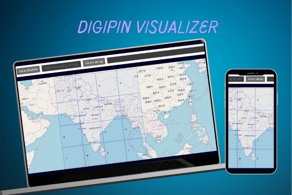
? DIGIPIN Visualizer Features
Explore hierarchical DIGIPIN tiles overlaid on an interactive map.
Convert seamlessly between DIGIPIN codes and GPS coordinates.
Click any grid cell to reveal its unique alphanumeric code and details.
Jump to any location using DIGIPIN or Latitude/Longitude input.
Optimized for fast performance and smooth experience on all devices.
? Technologies Used
- Leaflet.js – Interactive map rendering
- JavaScript (ES6) – Core logic and UI interactivity
- HTML5 + CSS3 – Structure and styling
- Open Data – DIGIPIN grid definitions and references
? Explore the Project
? GitHub Repository
? Live Demo
? Learn more about DIGIPIN: Department of Telecommunications
?? Author
Developed by Raja Babu Mahato (Raja GeoDev)
? rajageodev.com
? LinkedIn